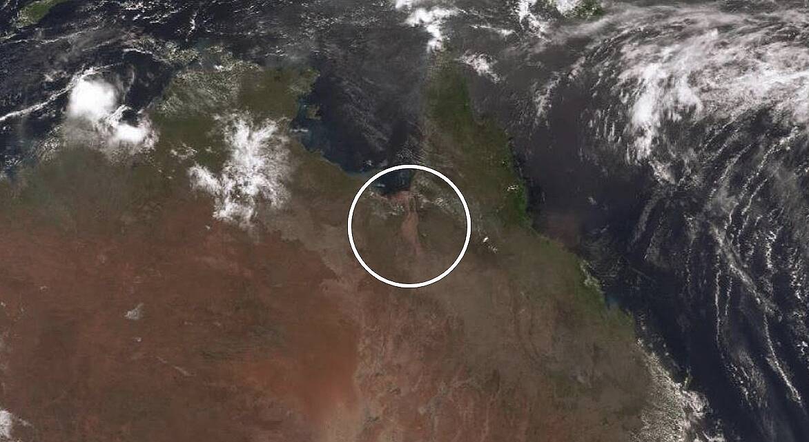
The Flinders River has experienced its most significant flooding in the last 50 years with the overflowing river appearing on the weather bureau's satellite images, having grown from a modest stream to 70 kilometres in width.
Subscribe now for unlimited access.
or signup to continue reading
The river and surrounding areas had broken yearly rainfall records, with the river receiving its annual rainfall total in a matter of 10 days and some places copping 800 millimetres.

Bureau of Meteorology issued a major flood warning for the lower Flinders River and a moderate flood warning for the Norman River, and flood warning for the Gilbert River on Thursday.
BoM meteorologist Adam Blazak said record rainfall in places due to the flood was also breaking out into nearby catchments.
"There are major flood warnings for Lower Flinders and downstream at Richmond and Walkers Bend will remain above major flood level this weekend and into the following week.
"It will take a while for the flood to work its way back to the Gulf, into the ocean but there is no further significant rainfall expected over the next few days."
Mr Blazak said he had seen rivers overflow out west due to floods but never like this.
"It's particularly large and it stretches about 700 kilometres long and 70 kilometres wide, which is quite a lot and has managed to spread over the land," he said.
"Richmond has received 490 millimetres and Julia Creek has had 482 millimetres this month, which is surprising because they've never had those rainfall totals in February and they've broken their annual rainfall.
"We haven't seen anything close to those numbers since 1940 when they had 450 millimetres."
Meanwhile, police officers on the ground are saying north Queensland remained a disaster zone but communities were keeping themselves in good spirits despite the devastation around them.
Charters Towers Inspector Dean Cavanagh, who was sent to Richmond to assist, predicted it would take months for the community to recover.
"The whole process in terms of support and getting life back to as normal as possible will take a long time," he said.
"The thing that stands out is every single person has been affected, there is complete devastation for graziers and land holders and it has impacted everyone.
"The property owners and graziers are the lifeblood of this region and we rely on them as much as they rely on us.
"There's a lot of work to do but fortunately, the community is banding together and it's inspirational to see everyone pulling together in a short amount of time."
Inspector Cavanagh said no one could have seen the weather event coming.
"A lot of property owners know their country and weather patterns and on day one, they were putting things into place to move their cattle, open fences and whatever else they usually do but no one could’ve planned for this," he said.
Inspector Cavanagh said council and the disaster management team were well-prepared to help the residents affected.
"Air support is essential and council seems to have prepared both emergency services' pilots but also local residents from a local flying area are on deck," he said.
"These amazing chopper pilots were here with just one phone call , surrounding the areas to assist."
Premier Annastacia Palaszczuk said more than $8 million had been paid in emergency hardship assistance for the floods to more than 46,000 people.
Ms Palaszczuk said the Australian Defence Force had used surveillance aircraft to map routes through the disaster zone.
"And the news is encouraging," she said.
"Most roads are opened, easing fodder delivery by road but the paddocks are stick thick with mud and will remain that way for a while yet."
The state's flood appeal has raised more than $4.4 million and the charity GIVIT has connected more than 9000 donated items to community members.

